A dialogue focused on the fascinating past of England through the exploration of local military history.
Maps & Geography
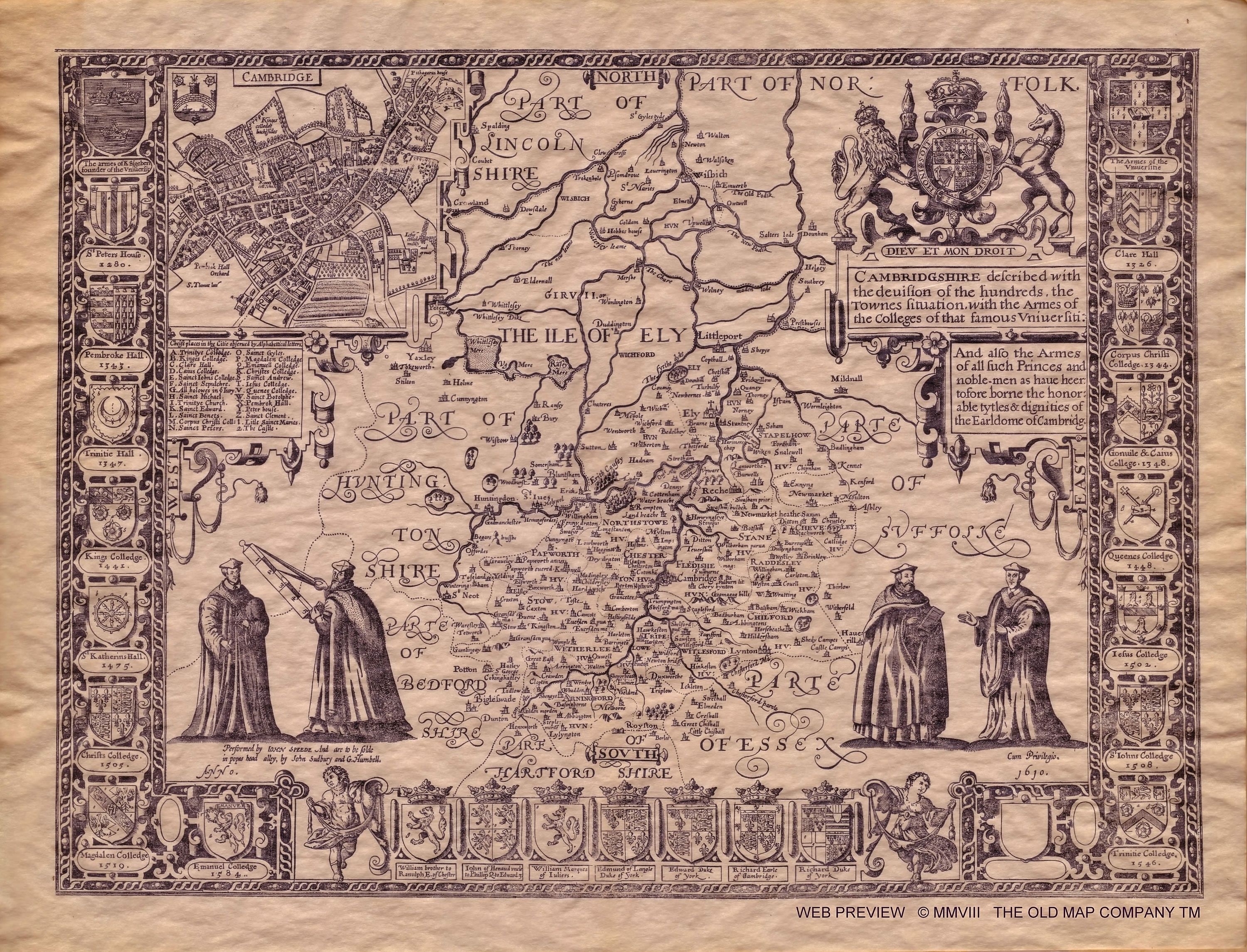
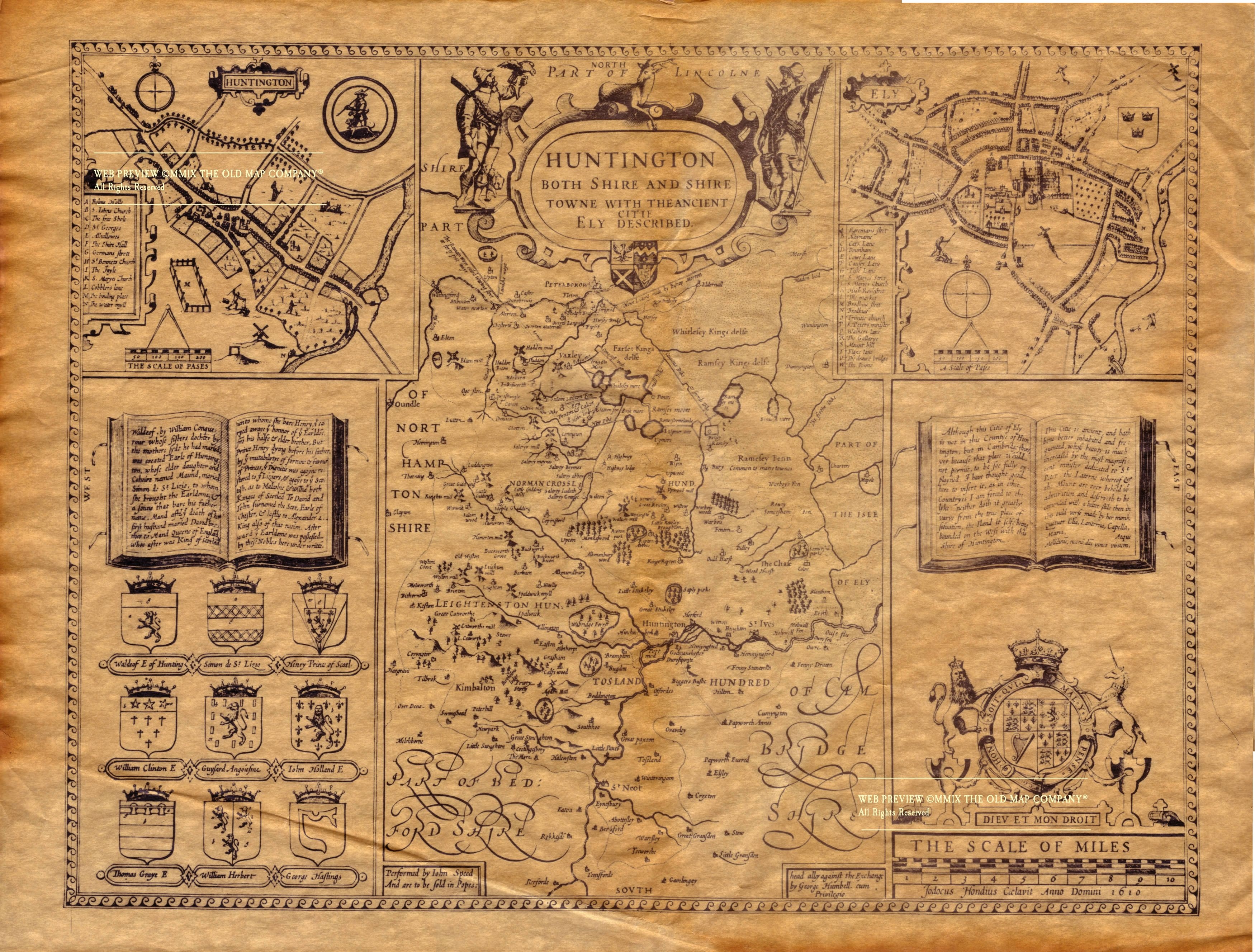
Cambridgeshire was historically known as the County of Cambridge, and over time has grown to encompass other shires and towns. In 1965, Cambridgeshire and the Isle of Ely were combined and later Huntingdonshire and the Soke of Peterborough were brought together to form the modern county in 1974. While Cambridge remains the county town, famous for its world-renowned university, the Shire encompasses the cities of Huntingdon and Peterborough as well, and the Cathedral city of Ely. Below are two maps from John Speed’s famous 1610 publication of Cambridgeshire and Huntingdonshire:
“John Speed – Map of Cambridgeshire – 1610 – 001” by John Speed – http://www.oldmap.co.uk. Licensed under Public domain via Wikimedia Commons.“John Speed – Map of Huntingdonshire – 1610 – 001” by John Speed – http://www.oldmap.co.uk. Licensed under Public domain via Wikimedia Commons.
The Isle of Ely, once almost inaccessible due to its location in the fens, was brought into Cambridgeshire as well. Below is a map from 1648 of the Isle of Ely:
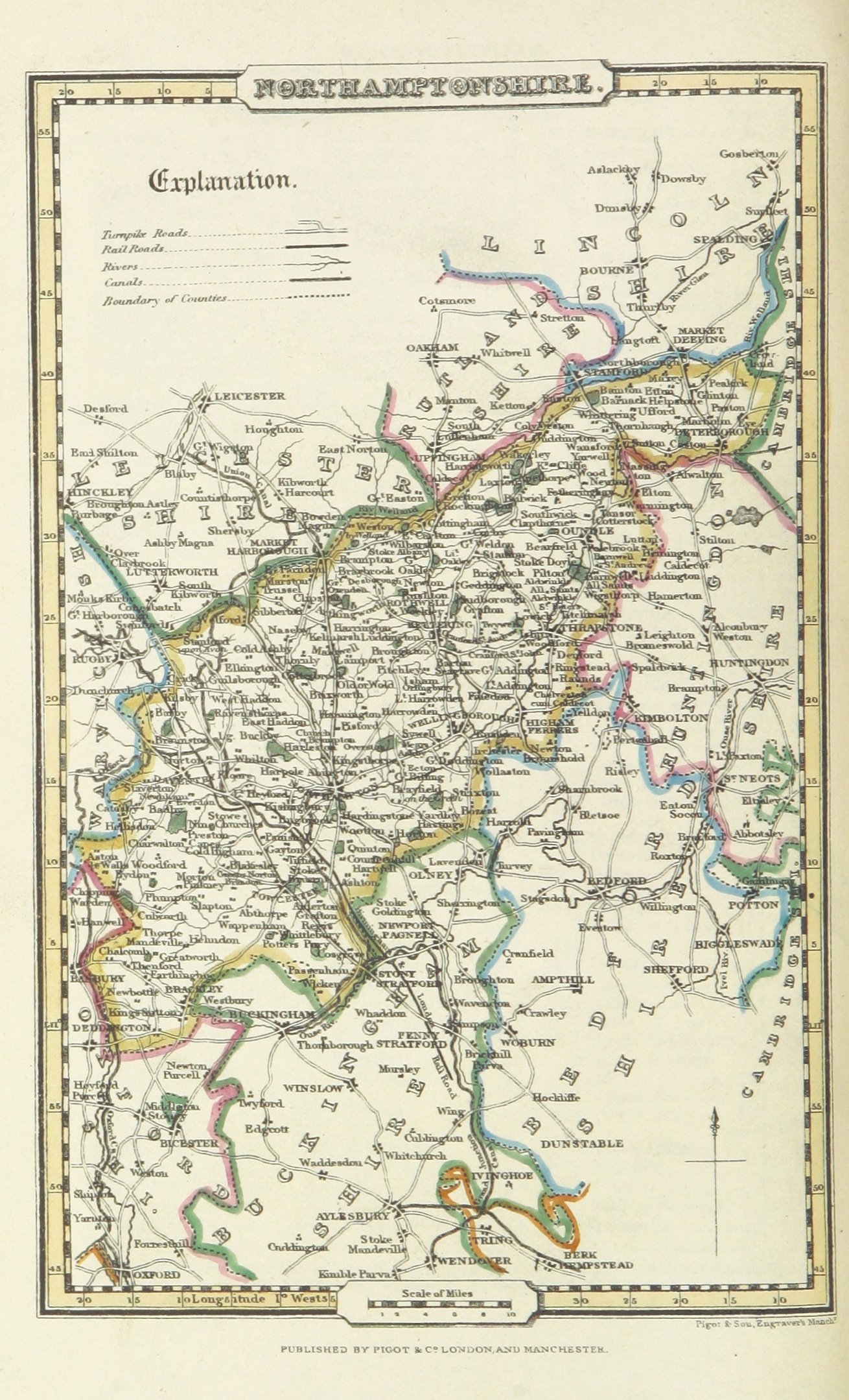
Isle of Ely 1648, by Joan Blaeu [Public domain], via Wikimedia CommonsThe Soke of Peterborough, a hisotical name for the modern city of Peterborough, once belonged to Northhamptonshire, and is visible in the northeast corner of the Shire below:
“Pigot and Co (1842) p2.280 – Map of Northamptonshire” by Image extracted from page 280 of volume 2 of A Pocket Topography and Gazetteer of England. … Illustrated by maps of the English counties, and vignettes of cathedrals, etc, by James Pigot and Co. Original held and digitised by the British Library. This file is from the Mechanical Curator collection, a set of over 1 million images scanned from out-of-copyright books and released to Flickr Commons by the British Library. Public domain via Wikimedia Commons.
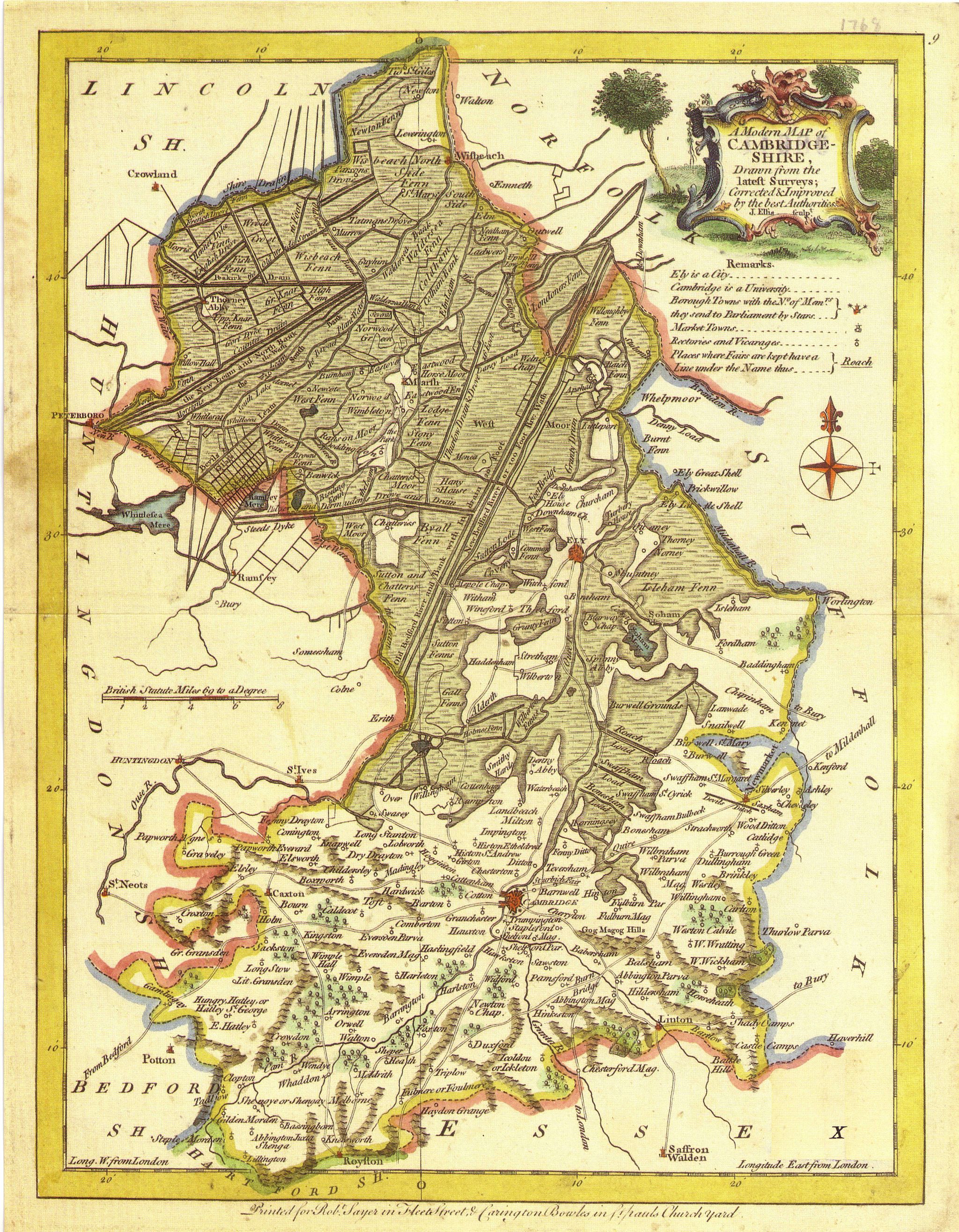
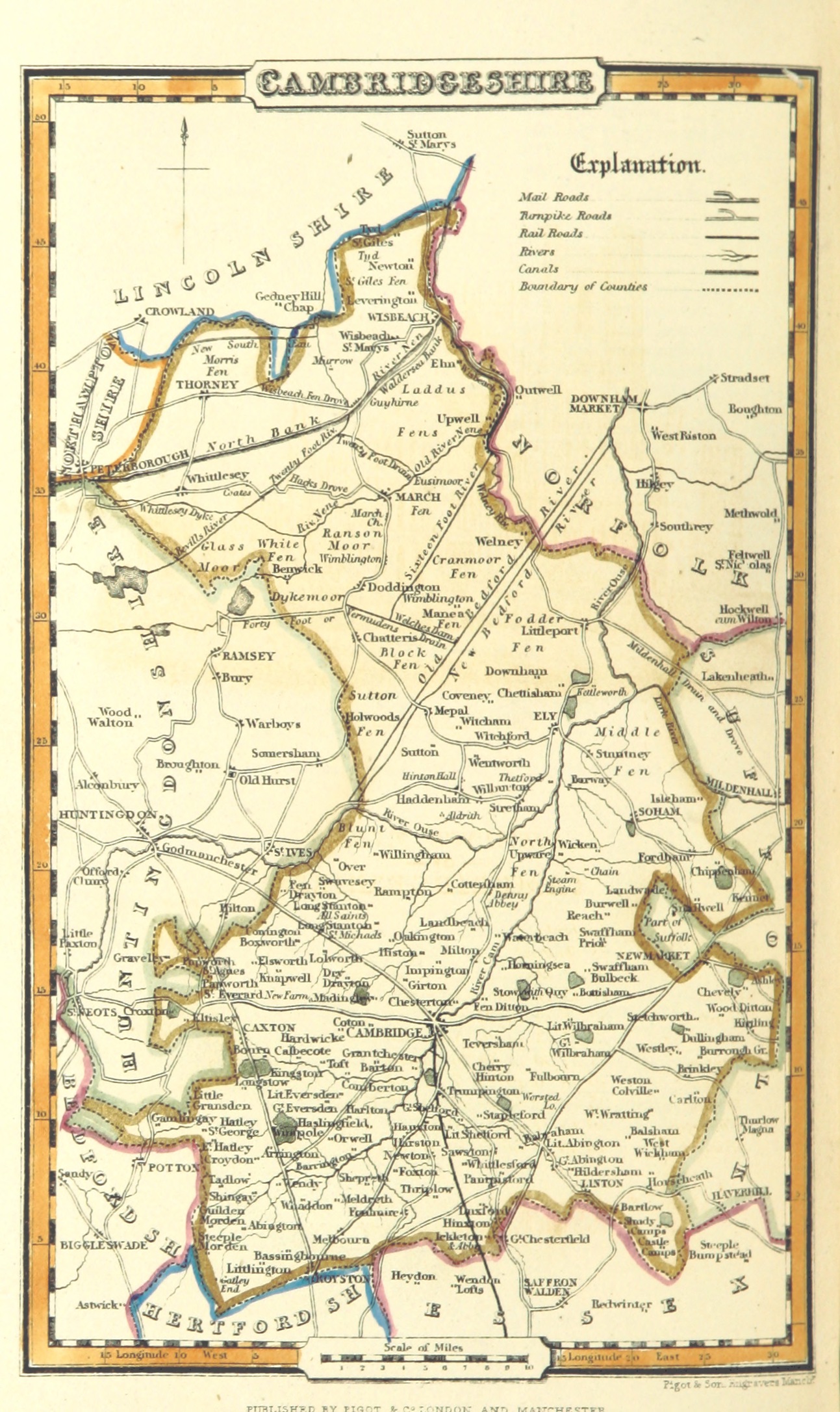
The excellent map above was from Pigot and Co., 1842. Their 1842 survey and publications have been scanned and provided to the public by the British Library, a treasure resource to us all. Below is the 1842 map of Cambridgeshire:
“Pigot and Co (1842) p2.280 – Map of Northamptonshire” by Image extracted from page 280 of volume 2 of A Pocket Topography and Gazetteer of England. … Illustrated by maps of the English counties, and vignettes of cathedrals, etc, by James Pigot and Co. Original held and digitised by the British Library. This file is from the Mechanical Curator collection, a set of over 1 million images scanned from out-of-copyright books and released to Flickr Commons by the British Library.View in BL GeoreferencerView image on FlickrView all images from bookView catalogue entry for book.English. Licensed under Public domain via Wikimedia Commons
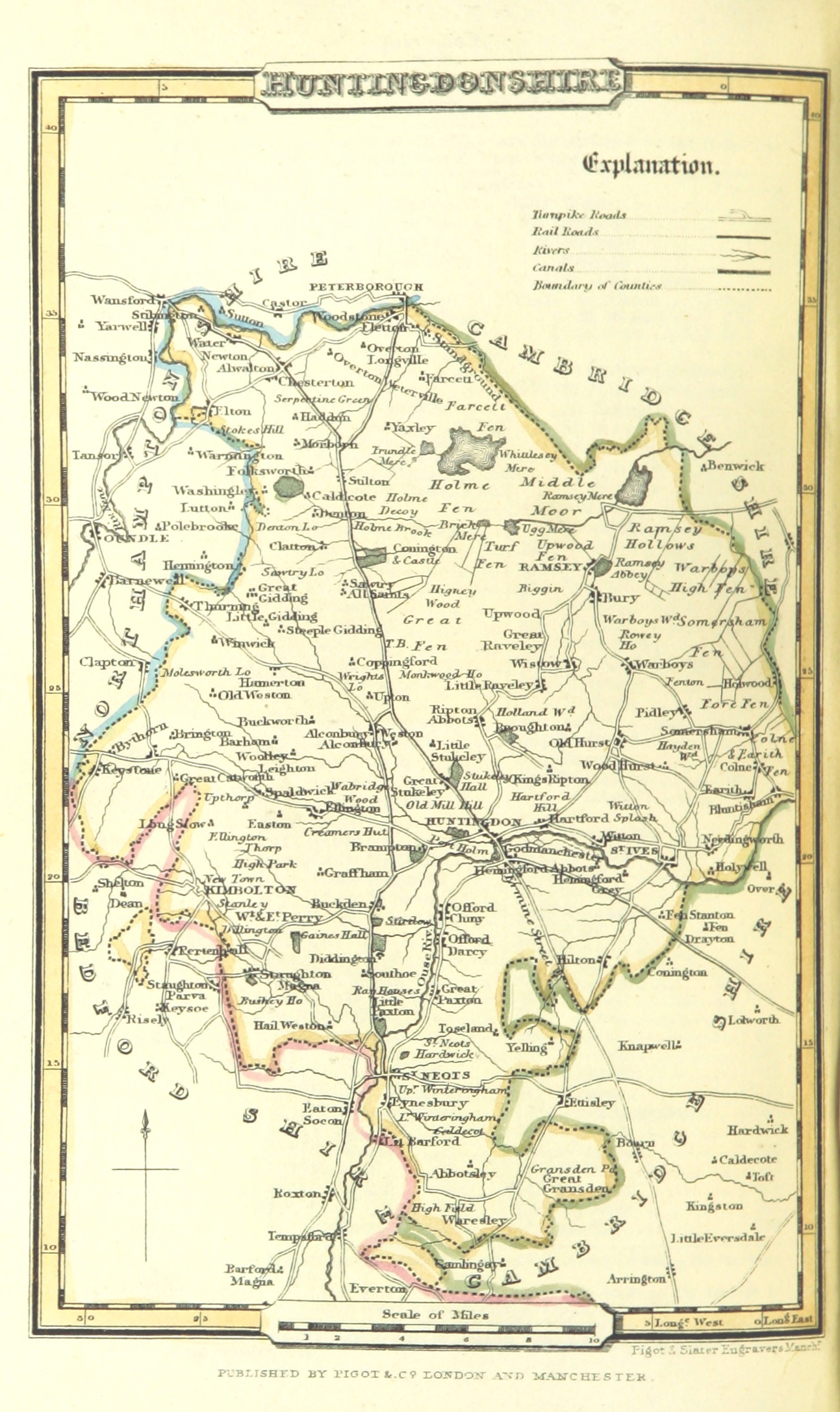
And their 1842 map of Huntingdonshire:
“Pigot and Co (1842) p1.304 – Map of Huntingdonshire” by Image extracted from page 304 of volume 1 of A Pocket Topography and Gazetteer of England. … Illustrated by maps of the English counties, and vignettes of cathedrals, etc, by James Pigot and Co. Original held and digitised by the British Library. This file is from the Mechanical Curator collection, a set of over 1 million images scanned from out-of-copyright books and released to Flickr Commons by the British Library.View in BL GeoreferencerView image on FlickrView all images from bookView catalogue entry for book.Licensed under Public domain via Wikimedia Commons.