The Round Church: A Crusader Legacy in Cambridge

On 15 July 1099, Jerusalem fell to the armies of the First Crusade. Their stated goal, as the soldiers poured into the city set on murder, rape, and pillage was to wrest the Church of the Holy Sepulchre and other holy places from the Armies of Islam and establish a Christian Kingdom with its capital at Jerusalem. These Crusader States would stumble on but effectively ended in 1291 when the Kingdom of Jerusalem fell after the siege of Acre. The last stronghold of Outremer (the term used by the Frankish knights, simply French for overseas), Acre fell to the Mamluks and despite numerous additional Crusades, the Levant would remain in the control of a succession of Islamic States until seized by the British and French from the Ottoman Turks in the Great War.

The Church of the Holy Sepulchre was built in the early 4th Century during the reign of Constantine the Great. According to tradition, it contains both Golgotha, the site of Jesus’ crucifixion, and the tomb in which he was buried and rose from the dead. It underwent both Byzantine and Crusader modifications and changes, but its round design was established and known by the Middle Ages across Europe.

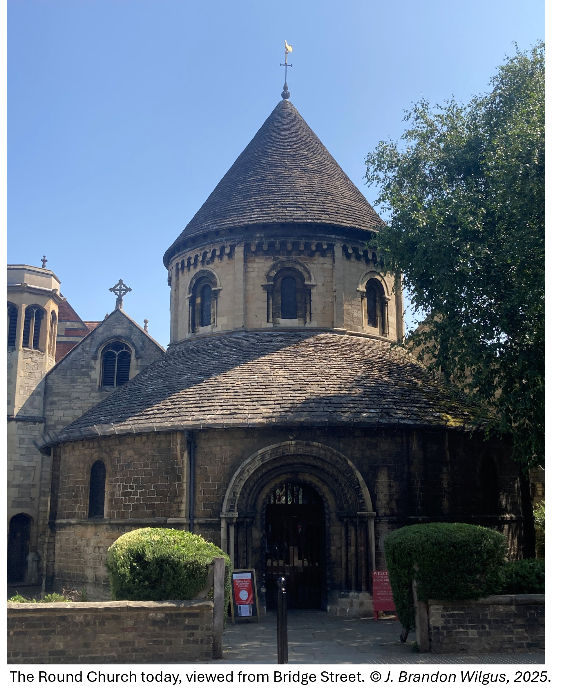
After the First Crusade, newly established religious orders such as the Knights Templar (Poor Fellow Soldiers of Christ and of the Temple of Solomon) and the Knights Hospitaller (Order of the Knights of St. John of Jerusalem), along with pilgrims who had visited Jerusalem, returned to Europe and built churches which emulated the Church of the Holy Sepulchre.  Mimicking the circular shape seen in Jerusalem, a handful of Round Churches were built across England recalling the site in Jerusalem of Christ’s passion and resurrection.

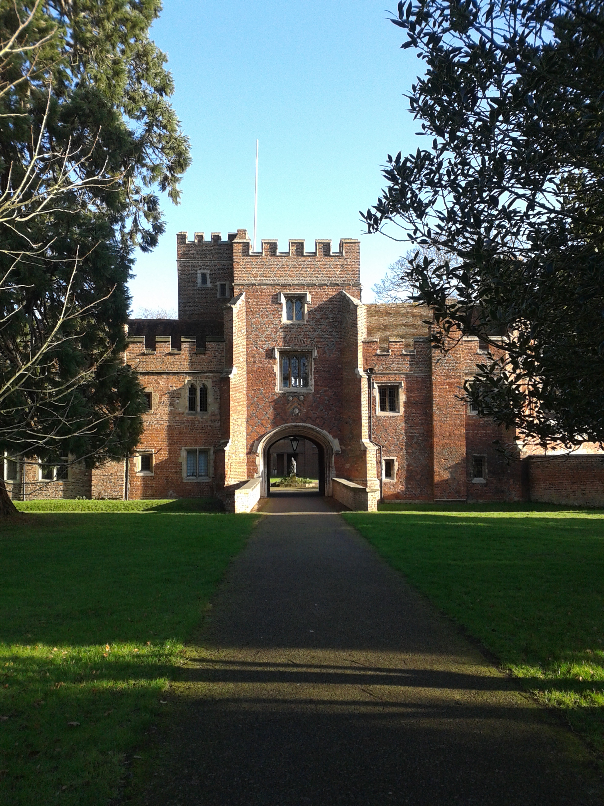
Between 1114 and 1131, only 15 years after the fall of Jerusalem, the Round Church in Cambridge was founded by an obscure group which we know little about which called itself The Fraternity of the Holy Sepulchre. In fact, there is no other record of this group except from this one project, and it was likely formed for the sole purpose of building the Round Church in Cambridge. The Fraternity claimed that the construction was “in honour of God and the Holy Sepulchre”. Consecrated as “The Church of the Holy Sepulchre”, it has been commonly called “St. Sepulchre’s” or simply, “The Round Church” since the 13th Century. This predates Cambridge University by almost a hundred years.

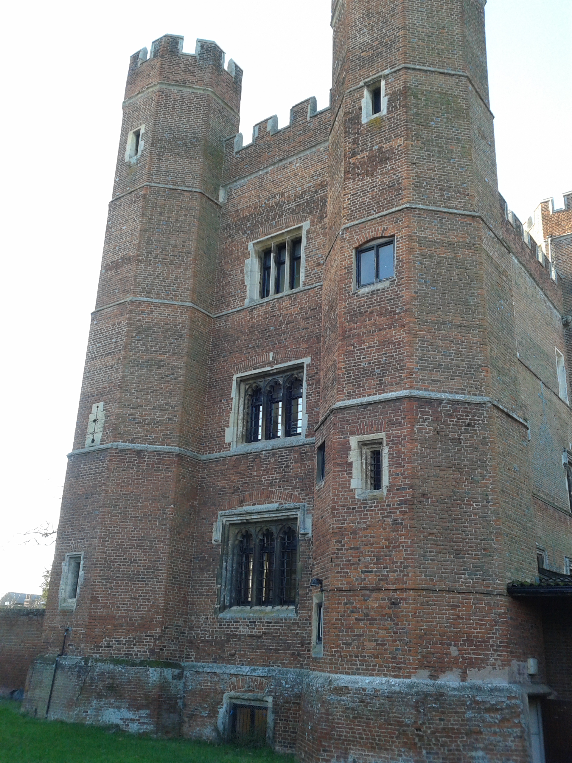
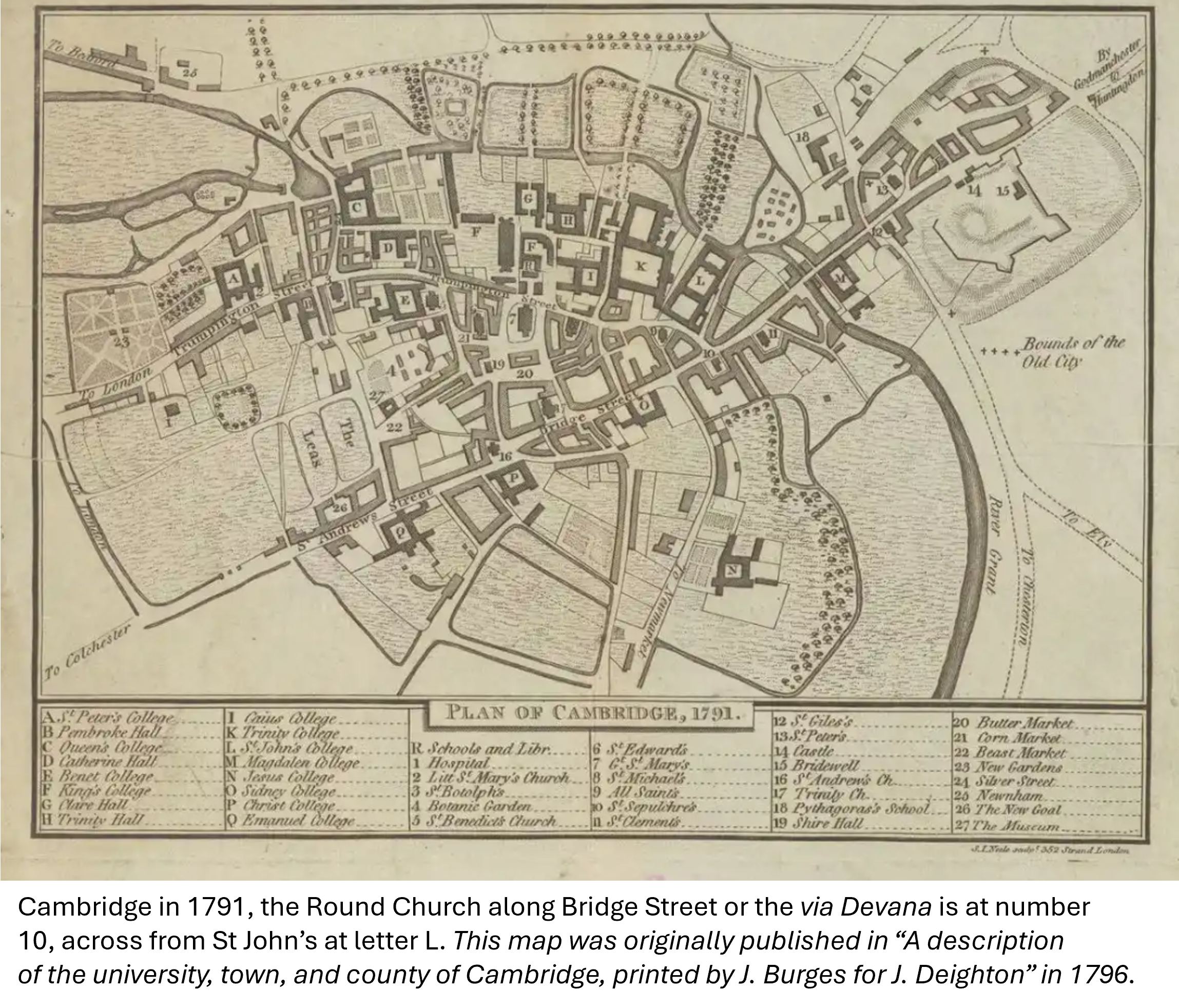
The first vicar of the Round Church was recorded as Geoffrey of Alderhethe in 1272. He was the Master of the Hospital of St. John the Evangelist, a religious hospital which resided across Bridge Street from the Round Church.  (Bridge Street today is the old Roman Road, the via Devana, which ran from Huntingdon to Cambridge, crossed the Cam, and passed the Roman Fort of Duroliponte which is now Castle Hill.) The medieval Hospital is now St. John’s College, part of the University of Cambridge.

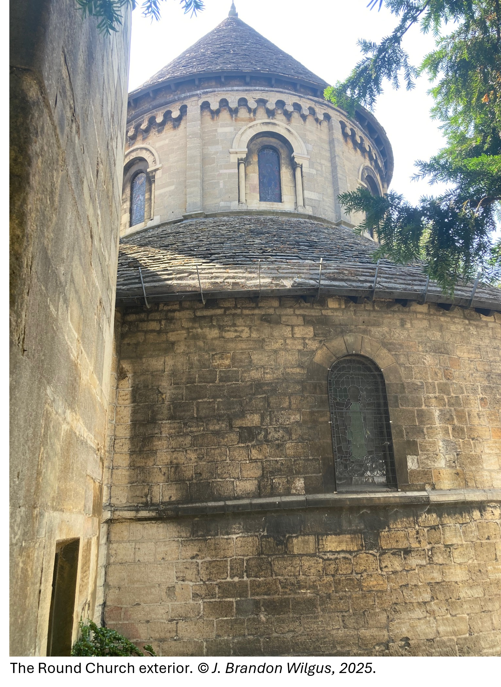
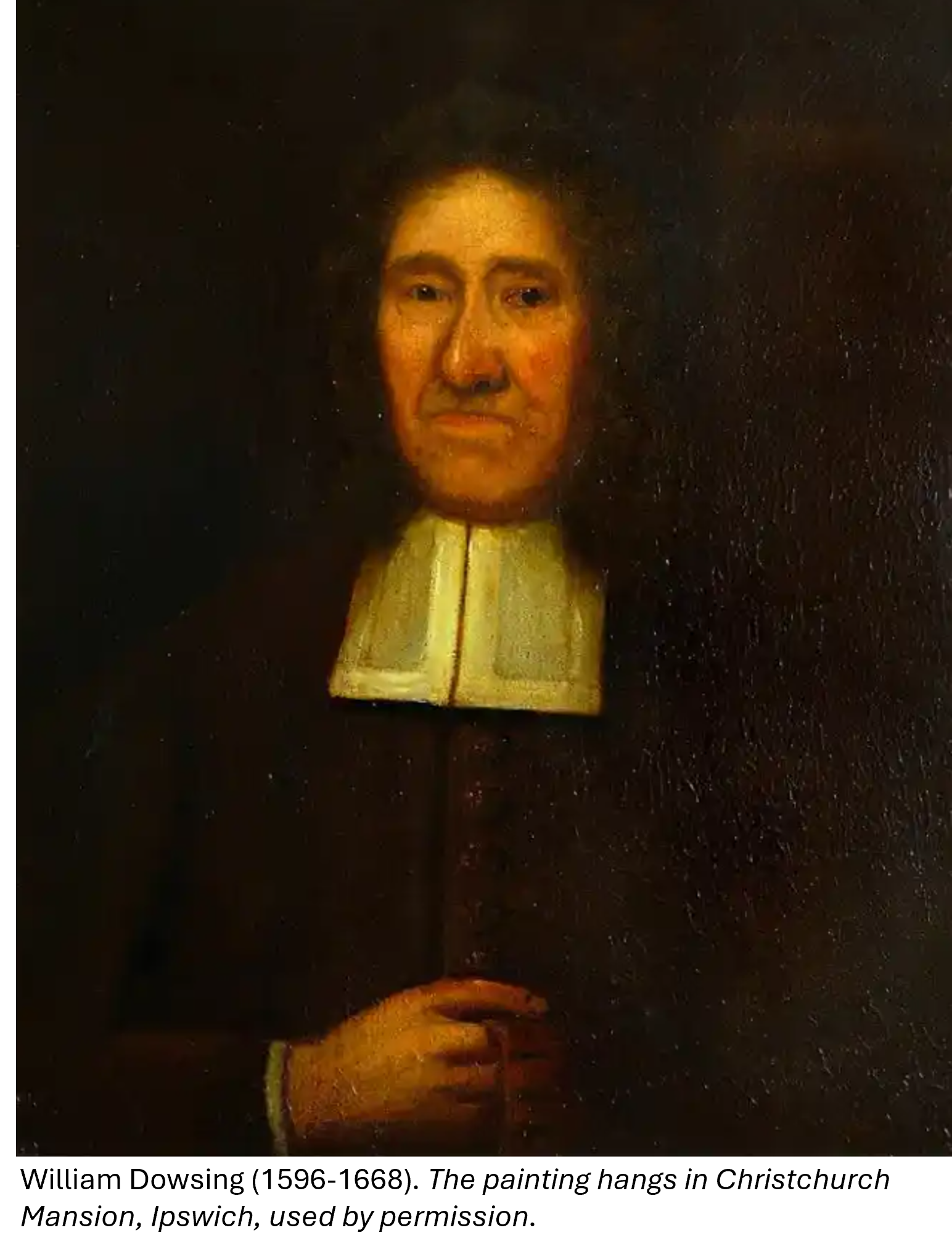
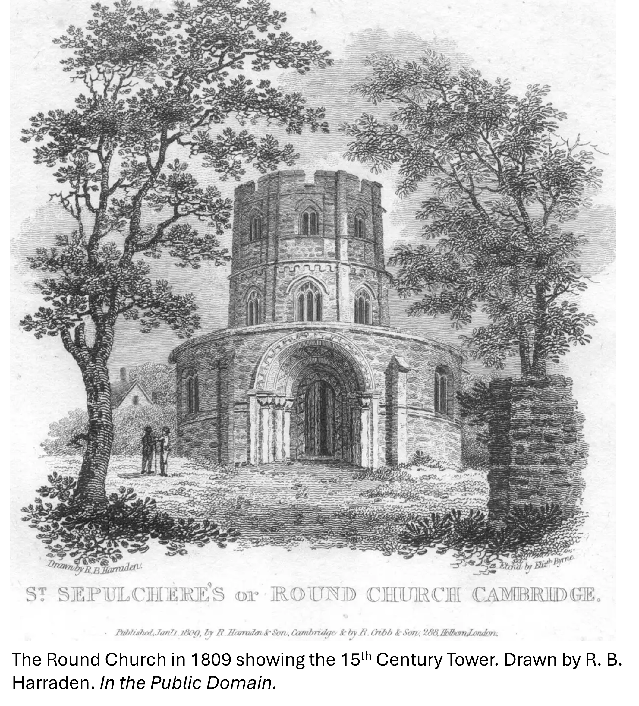
Expansions and extensions occurred over the next centuries, including a crenelated, multi-story tower which was added to the centre of the church in the 15th Century. At the same time, the Norman windows were replaced with larger, arched gothic windows. The church remained mostly undisturbed until 3 January 1644, when the Puritan officer and notorious iconoclast William Dowsing, known as “Smasher Dowsing”, arrived. Following the Parliamentary Ordinance of 28 August 1643 that “all monuments of Superstition and idolatry should be removed and abolished”, he and his soldiers destroyed fourteen pictures in the Round Church during the Civil War.  

In August 1841, the 15th Century tower collapsed, damaging the original structure and threatening the entire church’s existence.  A subscription for public support occurred and money raised for the church to be returned to its former glory.  In October 1843, with Queen Victoria and Prince Albert in attendance, the church was reopened after its reconstruction, returning it much to its original form. The upper portions of the church were returned to their Romanesque origins, the Georgian box pews were removed, and the gothic windows were restored to their original design. However, the reconstruction was not without controversy. The Camden Society, which coordinated the reconstruction, had a stone Altar and Credence Table placed in the nave, which was seen as too High Church, popish and Catholic. A general outcry led to a well-publicized court case and in January 1845 the altar and table were ordered removed and replaced by more humble, wooden tables which can still be seen today.

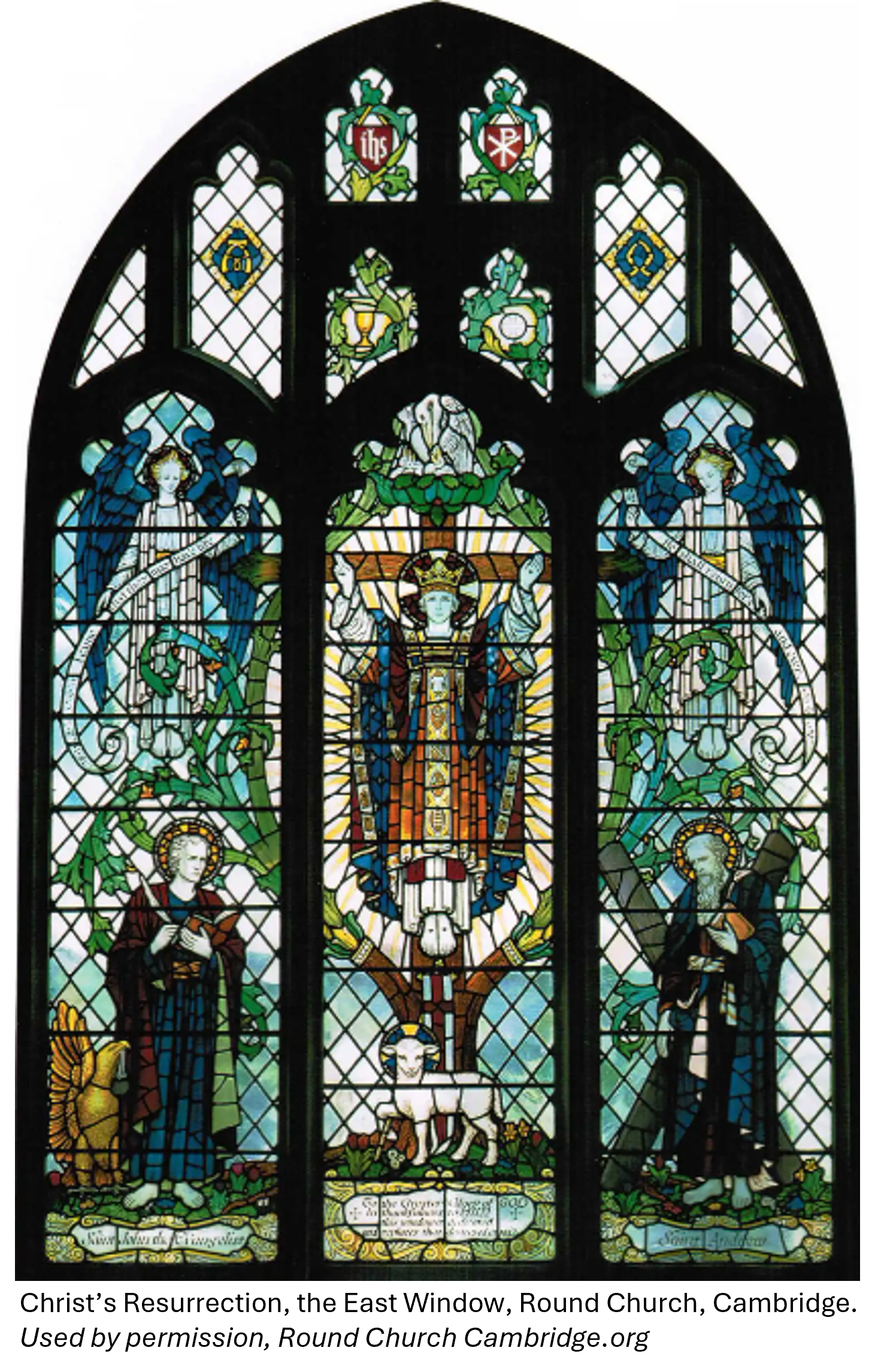
One would have thought there would be no more war damage to the Round Church after the iconoclasm of 1644, but on 28 July 1942 a single German bomber dropped its ordnance of high explosives and incendiaries on Cambridge. The bombs did extensive damage along Bridge and Sidney Streets, killing three people and wounding seven. One bomb struck the Cambridge Union Society Building, which had been built on the Church’s former graveyard, causing the medieval stained glass in the East Window to be blown out and destroyed.  After the war, the window was beautifully replaced with new stained glass showing Christ’s Resurrection, which occurred on the site of the Church of the Holy Sepulchre in Jerusalem.

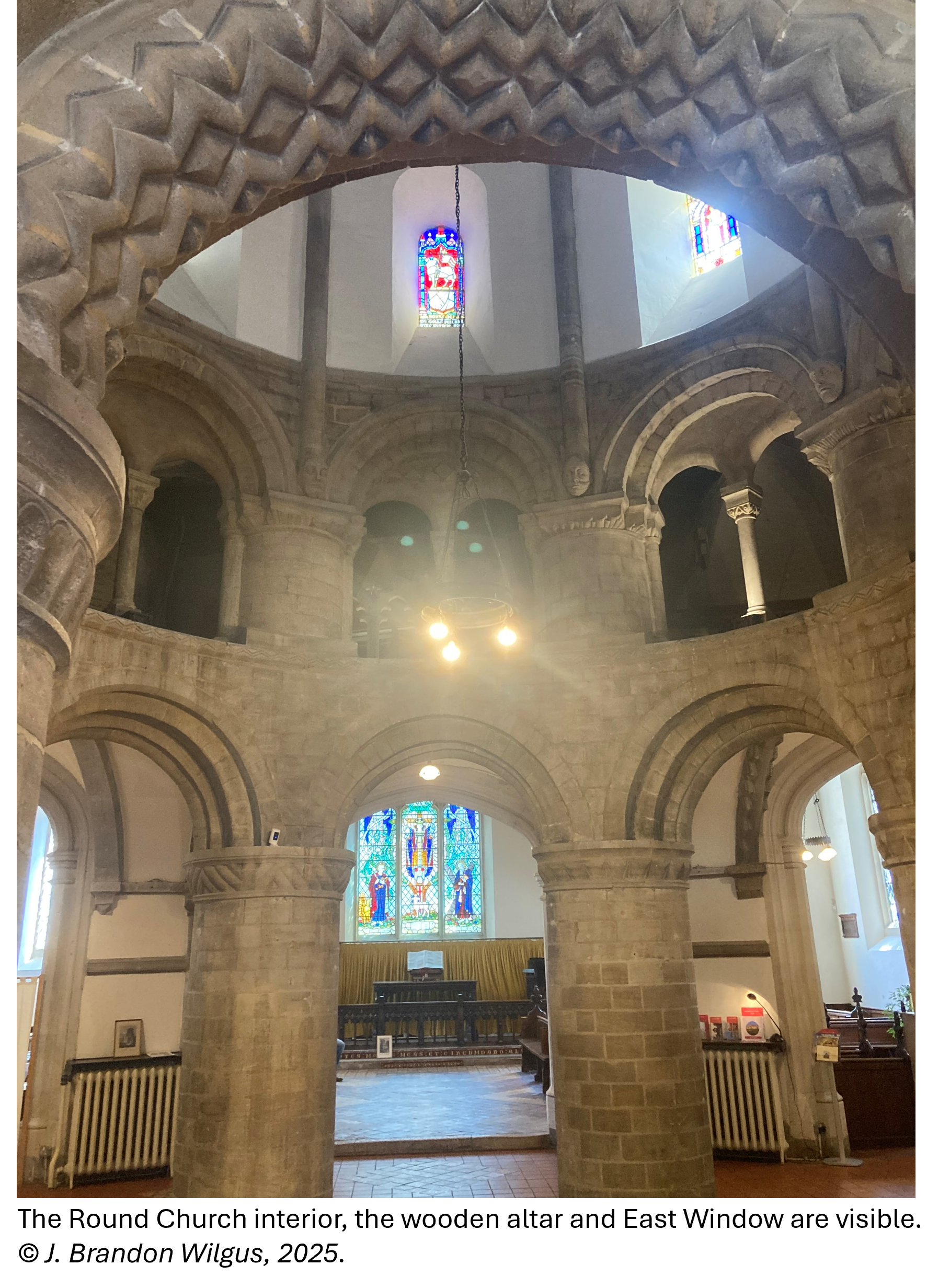
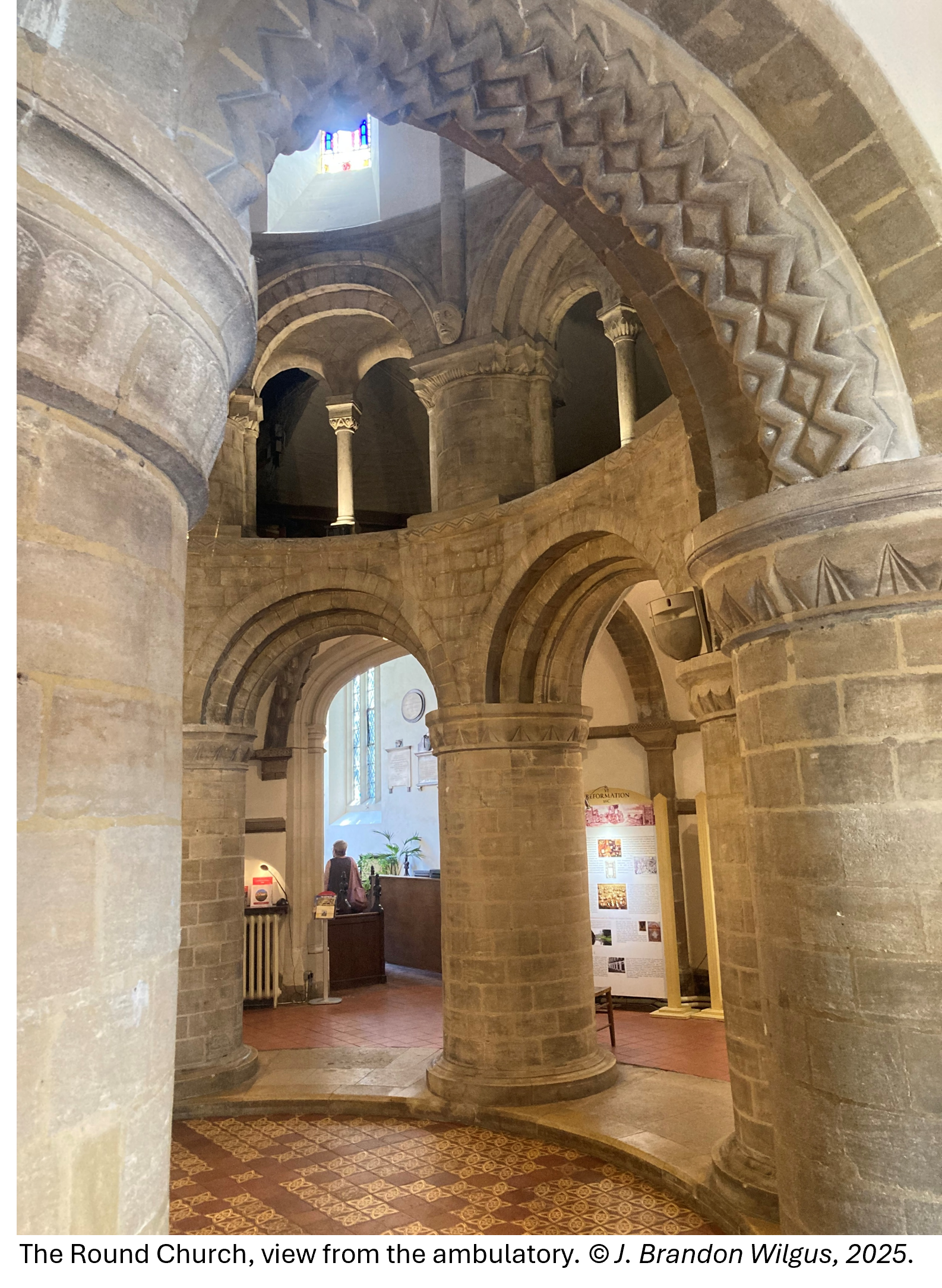
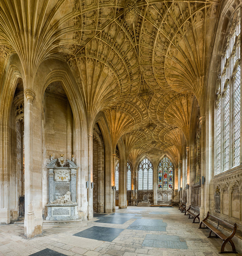
Inside, the church strikes a visitor as both beautiful and small, focused more on the center of the Round Church than the altar which rests in the nave, surrounded by the raised ambulatory. Eight thick Norman columns with round arches break the ambulatory and the nave and hold up an upper floor.  Much of the stained glass is from the Victorian era restoration and from the 1946 window which repaired the German war damage.  The tiled floor, which includes Queen Victoria’s coat of arms, dates from the 1841 restoration.

The Round Church Cambridge is one of four remaining medieval round churches in England. The others are the Temple Church in London, The Holy Sepulchre Church in Northhampton, and the Church of St. John the Baptist in Little Maplestead – all beautiful with a fascinating history and worth a visit.

To find out more about the Round Church’s visiting times, walking tours, and events see https://roundchurchcambridge.org/

To learn about its architecture and its evolution over the years, visit: https://drawingmatter.org/the-future-of-the-past/

To learn more about the church’s restoration, see Chris Miele’s “The Restoration of the Round Church, Cambridge”, English Heritage, Historical Analysis & Research Team Reports and Papers (First Series, 5), 1996.

To learn more about the bombing raids on Cambridge during World War II, visit Cambridge Historian: https://cambridgehistorian.blogspot.com/2012/07/world-war-2-air-attacks-on-cambridge.html

Ypres: The Menin Gate

It is a somber place, the Ypres Salient, where so many young men perished between 1914 and 1918. I have begun a series of hikes around the many battlefields, following Paul Reed’s excellent guide: “Walking Ypres”. However, my exploration of the Ypres Salient rightly begins at the Menin Gate, a memorial to the British and Commonwealth soldiers missing from the beginning of the war until 15 August 1917. It was then that 55,000 names of missing men had been reached and additional names would be recorded on other memorials around the Salient. However, for the missing from Commonwealth countries: Australia, Canada, and South Africa, all their missing from the Ypres Salient are recorded at the Menin Gate. The memorial was built in the 1920s and unveiled in July of 1927. At the unveiling of the monument, Field Marshal Herbert Plumer, 1st Viscount Plumer, who had led forces in the Salient during the war, most notably at Messines Ridge, famously said of those with no graves: “They are not missing, they are here.”

Originally, the gate was an opening in the 17th Century walls built by Vauban which led from the medieval market town of Ypres to the town of Menin some miles away to the east. During the war, the opening in the walls led to the front, and as the war progressed, hundreds of thousands of men would pass from the town through the destroyed portal to the trenches and dugouts which surrounded the tenuous British position in the salient. Ypres itself came under increased German shelling throughout the war and was almost completely destroyed by the armistice in 1918. Soldiers passing from Ypres through the ruined walls to the trenches were said to joke: “tell the last man through to bolt the Menin Gate.”

Beginning in July 1928, only interrupted during the German occupation during the Second World War, the Last Post Buglers’ Association has played the Last Post at 8 pm each evening under the arch of the Menin Gate. In fact, as Ypres was liberated by Polish forces in the Second World War, the ceremony was bravely resumed by local firefighters while fighting continued in the town. It is a moving ceremony and a credit to the Belgian allies of Great Britain, the citizens of Ypres, who have maintained this somber tradition for almost a hundred years. Each night, traffic is stopped and visitors stand silently as the buglers play in unison the Last Post, which echoes under the gate and among the 55,000 names of the missing. It is fitting to feel overcome by a sense of loss and tragedy at such a moment.

For more information on the Last Post Buglers’ Association, or to schedule a wreath laying at the Menin Gate, visit their website: https://www.lastpost.be/en/ceremonies/participation

Ruins of a Roman Bath and the Foundations of a Castle – Ravenglass and Muncaster

Traveling west from Hardknott Pass (and the Roman Fort I recently blogged about) down to the coast of the Irish Sea is the modern village of Ravenglass – the Roman Port of Glannaventa.  Almost two millennia ago, this was a key port in Roman Britain.  Glannaventa connected the border fortresses with the maritime supply lines essential for supporting the garrisons with food, supplies, and reinforcements.  These forts protected the northern border of the empire before Hadrian’s Wall was constructed. The port was also necessary for the export of silver and lead mined in the Lake District to mainland Europe and the greater Roman Empire.  As is often the case with important centres of trade, the port thrived and grew alongside the military encampments, eventually leisure facilities were constructed.

Column and archway of the Ravenglass Bath House.  This area connects the into the room where the Hypocaust was discovered (the underfloor plumbing system that provided heating). © Brandon Wilgus, 2015.
Column and archway of the Ravenglass Bath House. This area connects from an area where the Hypocaust was discovered (the underfloor plumbing system that provided heating). © cambridgemilitaryhistory.com, 2015.

On the outskirts of the Roman town stood a sprawling bath house or Thermae in Latin, which is remarkably still standing and carefully preserved.  Brick walls 13 feet (4 meters) high remain, with curved arches over doorways.  Under the earth are additional foundations, visible now only under the raised ground, but clearly showing the impressive size of the bath house.  The Thermae stood next to a large fort, which is now buried in the Cumbrian landscape – some of the village, roads, and a railway all cross the archaeological site.  However, the initial excavations from 1881 have been expanded in recent years and it now appears the extent of the Roman encampment is greater than once believed.  Just south of the bath house, along a public foot path which crosses the rail line, work is being conducted on the foundations of barracks which once housed the garrison of Glannaventa.

Part of the Ravenglass Bath House.  The two doorways pictured lead from the area archeologists have identified as the changing area to the bathing rooms.  © Brandon Wilgus, 2015.
Part of the Ravenglass Bath House. The two doorways pictured lead from the area archaeologists have identified as the changing area to the bathing rooms. © cambridgemilitaryhistory.com, 2015.

Of note, a mile’s walk from the Bath House is Muncaster Castle, home of the Pennington Family and the Barons Muncaster.  The beautiful castle, occupied by the Pennington family for over 800 years, is built on an elevated wall which is now believed to have been a Roman fortification – the ruins of which were used as the foundations of the castle.

Muncaster Castle, a mile east of the Ravenglass Roman Bath House.  The foundations of Muncaster were built upon Roman Ruins 800 years ago.  © Brandon Wilgus, 2015.
Muncaster Castle, a mile east of the Ravenglass Roman Bath House. The foundations of Muncaster were built upon Roman Ruins 800 years ago. © cambridgemilitaryhistory.com, 2015.

The Ravenglass Roman Bath House is maintained by English Heritage, there is free access and free parking.  Muncaster Castle is a beautiful and historic Grade I property which is certainly worth a full day’s visit to enjoy the house and gardens: http://www.muncaster.co.uk.

After much traveling, I plan on returning to Cambridgeshire soon… Brandon.

Hardknott Roman Fort – the Borders of Empire

High in the mountain passes of the Lake District in northwest England, some distance from Cambridgeshire, lies a long ruined Roman fortress that once guarded the northern borders of the Roman Empire. It is hard to imagine a time when the beauty and tranquillity of Cumbria, now so often visited by hikers and outdoor enthusiasts, was a battlefield. In the early Second Century, during the reign of Emperor Hadrian, the Mediobogdum Fort was constructed along a chain of fortifications to prevent an invasion of Roman Britain (we are reasonably sure that Mediobogdum is now identified as the Hardknott Roman Fort). It was built along the mountain pass that left the port of Glannoventa (modern day Ravenglass) in the Eskdale Valley and crossed the hardknott mountain towards Windermere. Nowadays, the single-track road is notorious as the steepest and most treacherous mountain track in all of Great Britain, loved by motoring enthusiasts. One can imagine at the difficulty of garrisoning, supplying and constructing a military encampment high in the mountains of the Lake District – what is even difficult to access by auto today.

Hardknott Roman Fort, the Lake District, Cumbria. Hardknott peak is visible in the distance, and the Praetorium foundations are visible in the forground. © Brandon Wilgus, 2015.
Hardknott Roman Fort, the Lake District, Cumbria. Hardknott peak is visible in the distance, and the Praetorium foundations are visible in the forground. © cambridgemilitaryhistory.com, 2015.

This fort, built and occupied before Hadrian’s Wall was constructed several miles to the North, was at its time the last outpost of Empire – almost a thousand miles from the Imperial City of Rome. The remoteness of this posting would have been breath-taking for the 500 men and officers garrisoned here – who we know from extant Roman records were the Fourth Cohort of Dalmatians. These men were raised on the balmy eastern shores of the Adriatic Sea (present day Slovenia, Croatia, Montenegro, and Albania). They would have travelled overland across Europe and then sailed to western England to reach this hostile borderland, where conflict with Picts and other tribes from present day Scotland was a constant threat.

An overhead view of the fort, thanks to English Heritage for the photograph. © English Heritage, 2015.

Laid out with military precision, it is still easy to walk the perfect square of Hardknott Fort, 110 meters per wall, with four gates and corner towers. The road of the day would have entered the fort via one gate and led travellers, merchants, and local peasants out through the opposite, ensuring the soldiers could maintain control of the key mountainous terrain, the movement of people and goods, and the levying of customs taxes. One nowadays can walk through the foundations of the Commanding Officer’s Praetorium, or villa. You can easily picture the wooden supports that would have comprised the barracks for the soldiers, junior officers, and auxiliaries, and think on the remoteness of this post.   The foundations of the headquarters building, the granaries, and the forementioned Praetorium occupy the central ground of the fort. Just outside the northern gate is a parade field, a testament to the Roman Empire’s renowned discipline of its troops. A bit farther afield the ruins of a bath house remain, a reminder that not all of life in Mediobogdum would have been austere and grim.

Looking down on Hardknott Fort from the area of the parade grounds. © Brandon Wilgus, 2015.
Looking down on Hardknott Fort from the area near the granaries.  The foundations of the Cohort’s Headquarters are clearly visible with the Eskdale Valley stretching to the distance. © cambridgemilitaryhistory.com, 2015.

Today, Hardknott Fort is jointly preserved by both English Heritage and the National Trust. Not easily accessible, you must navigate the Hardknott Pass and then hike to the Fort, which is perched on the middle slopes of the Hardknott peak. Visit: http://www.english-heritage.org.uk/visit/places/hardknott-roman-fort/ for more information on the fort.

Hardknott Pass, the Lake District, Cumbria.  The single-track B-road which crosses from the Eskdale Valley to Windermere is the access point to the Roman ruins. © Brandon Wilgus, 2015.
Hardknott Pass, the Lake District, Cumbria. The single-track B-road which crosses from the Eskdale Valley to Windermere is the access point to the Roman ruins. © cambridgemilitaryhistory.com, 2015.

The Palace of Buckden, fortified manor house and jail of a queen

The gatehouse of Buckden Palace, © Brandon Wilgus, 2015
The gatehouse of Buckden Palace, © cambridgemilitaryhistory.com, 2015

Along the Great North Road, traveling from London through Cambridgeshire is the small, peaceful village of Buckden. Old coaching inns now have been turned into gastro-pubs, while the picturesque houses are smartly refurbished and often owned by those who make the long commute into London by train – the lost time more than worth living in the beautiful Cambridgeshire countryside. In the centre of Buckden, however, an ancient fortified manor house built in the 15th Century rises over the thatched and tiled roofs of the village, the bricks and stone having replaced the wooden 12th Century Bishop’s Palace which has long since disappeared. It was here that Katharine of Aragon was imprisoned and the Bishops of Lincoln lived, surrounded by crenulated walls, moat, and outer bailey. It speaks of an age when a bishop was a wealthy feudal lord, who led the diocese but also maintained an army.

The bricked towers of the fortified manor, added n 1475 by the Bishop of Lincoln, © Brandon Wilgus, 2015.
The bricked towers of the fortified manor, added in 1475 by the Bishop of Lincoln, © cambridgemilitaryhistory.com, 2015.

The brick towers of the fortified manor house were added in 1475, during the War of the Roses by the Bishops of Lincoln. It is during that period of conflict that the Bishop’s Palace appeared to reach the height of its defensive works – fortified manor with towers, crenulated interior wall, moat, and outer bailey. Sadly much of the defensive works were demolished during the Commonwealth in the 17th Century and in the 19th Century, but that cleared the way for some impressive later Victorian era buildings. The Bishops of Lincoln left the property in 1837. The moat was filled in 1871 as the Victorian buildings were finished and the Palace serves as a religious retreat to this day. The Claretian Missionaries now reside here, but the grounds are open for one to wander around and appreciate this ancient fortified manor house.

Many monarchs were entertained in the Bishop of Lincoln’s Palace at Buckden: Henry III stayed here in 1248, Edward I called the Longshanks and Malleus Scotorum was here for a time in 1291. Richard III visited the Palace in 1483, the first year of his short reign that would end two years later at Bosworth Field.

The Palace of Buckden is probably best known for holding Henry VIII’s first Queen, Katherine of Aragon during the King’s Great Matter, from July 1533 until May 1534 until she was transferred a few miles away to Kimbolton Castle, where she died in 1536. She would eventually be buried just north of both Buckden and Kimbolton at Peterborough Cathedral.

Miniature of Catherine Howard as Queen of England by Hans Holbein the Younger.  This image is in the public domain.
Miniature of Catherine Howard as Queen of England by Hans Holbein the Younger. This image is in the public domain.

Ironically, a few years after her death, an aging Henry VIII would stay at Buckden Palace with his fifth wife, Catherine Howard (she was 17 at their marriage; Henry was a gouty and obese 50). They stayed at the Palace in 1541, during a summer tour that the King and Queen took of England before her coronation. It was during this tour that Catherine would be accused of committing adultery with Thomas Culpeper which led to her beheading for treason in 1542. It is unknown what occurred between Henry and his penultimate wife while at Buckden Palace, but the fortified manor certainly served as a major setting for the drama of Henry’s love affairs – which ended so tragically for the two women who stayed at Buckden.

The interior of the fortified gatehouse which was once the access point to the inner courtyard of Buckden Palace. © Brandon Wilgus, 2015.
The interior of the fortified gatehouse which was once the access point to the inner courtyard of Buckden Palace. © cambridgemilitaryhistory.com, 2015.

Buckden has a helpful website with a well-written and informative section on the history of the village where the palace plays a central role: http://www.buckden-village.co.uk/history/

The Hedda Stone and Peterborough Abbey

Behind the main altar in Peterborough Cathedral, in an alcove of the Lady Chapel, lies an ancient stone carving: the Hedda Stone. This medieval carving of 12 monks, six on each side, commemorates the destruction of the Monastery and the death of the Abbot and Monks when the area was sacked by the Vikings in 864.

The Lady Chapel of Peterborough Cathedral, photo by DAVID ILIFF. License: CC-BY-SA 3.0

In the 7th Century, Cambridgeshire and its environs was dramatically different than we now know. The Shire was part of the Anglo-Saxon Kingdom of Mercia – one of the many fractured states of medieval England. Peterborough at the time was known as “Medeshamstede”, which translates loosely to “Homestead belonging to the Mede” and according to the Anglo-Saxon Chronicle, had gained this name from the monastery which was founded there in the 7th Century. The Venerable Bede also mentioned “Medeshamstedi”, a latinized version of the area, in 670. Despite these references to the Monastery at the site, Peterborough’s history is even more ancient, with its Bronze Age Settlements and Roman history, but those are discussions for another day.

The Medeshamstede Monastery, often called Peterborough Abbey by modern historians, was an important ecclesiastical centre in the Kingdom of Mercia, located along the River Nene, in a boggy area or fen. According to Bede and the Royal Charter of the Mercian King Wulfhere, the Monastery was founded by Sexwulf, who became its first Abbot, likely between 653-656. Hugh Candidus wrote many centuries later, in the 1100s, that Sexwulf built a great Monastery and “laid as its foundations some great stones, so mighty that eight yoke of oxen could scarcely draw any of them”. One can imagine the size and importance of the Monastery, which now forms much of the foundations of Peterborough Cathedral, for Candidus also wrote that Sexwulf strove “to build no commonplace structure, but a Second Rome, or a daughter of Rome in England”. The Monastery likely played a key role in the Christianization of Mercia through the establishment of daughter churches throughout the Kingdom. By all appearances, the Monastery thrived and was a centre of Christian scholarship until the Vikings came.

In 870, according to the Anglo-Saxon Chronicle, the Viking invasion of Mercia reached Medeshamstede and the Abbey was razed, the Monks slaughtered. The remarkable Hedda Stone, a two-sided carving that memorializes the massacre of the Abbot and Monks in 870, carved a few years after the event, is the most prominent surviving artifact from Medeshamstede. It is a haunting piece, for the eyes of the monks peer out from carved sockets, worn and weathered by time.

The Hedda Stone, Peterborough Cathedral, Cambridgeshire, England. This file is licensed under the Creative Commons Attribution-Share Alike 3.0 Unported license.

There are no contemporary recollections of the razing of the Abbey. However, the violence of Viking raids, the invasion and settlement of England which began in June 793, still shocks. The raid on the Abbey on the Holy Island of Lindisfarne, in Northumbira, was called an atrocity at the time. One contemporary wrote: “Never before has such terror appeared in Britain as we have now suffered from a Pagan race… The heathens poured out the the blood of saints around the altar, and trampled on the bodies of saints in the temple of God, like dung in the streets.”

Oxburgh Hall: the Wars of Religion in the East of England

Ancient seat of the Bedingfeld family, whose history stretches to the War of the Roses, Oxburgh Hall rises from the fens of southwest Norfolk.  An ancient fortified manor, which has been reworked and crafted for centuries, it was first conceived of and built in 1482 at the height of the Wars of the Roses.  However, at least back to 1086 Domesday Book records a settlement here named Oxenburch and a description: “a fortified place where oxen are kept”. Through the Wars of Religion, the catholic Bedingfeld family threaded a dangerous line at the Tudor Court and found themselves increasingly persecuted for their faith.  Staunchly royalist, Charles II rewarded the Bedingfelds with a baronetcy in 1661 though failed to repay the sizable loans made to the crown by the family.  As the 17th Century flowed into the 18th, the Bedingfelds found more acceptance of their Catholicism on the continent, and spent much time away from England and persecution.  Amazingly, almost 600 years after construction began, Oxburgh Hall retains its ability to awe and overwhelm, just as Sir Edmund Bedingfeld intended in 1482, and the family still resides in the eastern front of this ancient manor.

Aug-Sept 2014 048
Oxburgh Hall, Norfolk, seat of the Bedingfeld Family, the West Front. © cambridgemilitaryhistory.com, 2014

The violence of the War of the Roses, which demanded a strong defence along with the need to build an impressive manor for a rising family of influence in turbulent times, led to the interesting layout of Oxburgh Hall.  A large gatehouse covers the entrance to the manor, which is surrounded by a moat, and outer walls.  Arrow slits, moderate fields of fire over the approaches, and fortified gates enhance the security of the manor; however, Oxburgh would not have been able to withstand an assault or a siege – it was not a fortress.  Later, during the repression of Catholics during the English Reformation, a Priest Hole was added off the grand bedrooms located high in the gatehouse, to secretly hide a priest from the King or Queen’s soldiers.

Aug-Sept 2014 006
The gatehouse and moat of Oxburgh Hall. The curious blend of late-medieval defensive works are blended with windows and decorative brickwork to add comfort to this fortified manor. © cambridgemilitaryhistory.com, 2014

Oxburgh Hall is maintained by the National Trust and you can tour the inside of the manor, the gardens and the 1836 Catholic Chapel of the Immaculate Conception and St. Margaret on the grounds.  Directions to Oxburgh Hall, just north of Cambridgeshire, signposted 3 miles from the A134, near the village of Swaffham, SATNAV  postcode: PE33 9PS. The National Trust has a website on Oxburgh Hall: http://www.nationaltrust.org.uk/oxburgh-hall

Pax Brittania: The Earl de Grey as First Lord of the Admiralty

Photo by Brandon Wilgus, August 2014
Wrest Park, designed by the Earl de Grey, viewed from the formal gardens, looking at the Boudoir of the Countess de Grey © cambridgemilitaryhistory.com, 2014

Photo by Brandon Wilgus, August 2014
Wrest Park, Bedfordshire, home of Thomas Philip de Grey, called The Lord Grantham from 1786-1833, 1st Lord of the Admiralty from 1834-1835, the Earl de Grey © cambridgemilitaryhistory, 2014

Traveling west across the shire’s border are the rolling hills and farmlands of Bedfordshire, where Thomas Philip de Grey (1781-1859) designed and built his beautiful French-inspired rococo country home at Wrest Park.  The interiors spill onto sunny terraces which open to the formal gardens and riding lanes that fan away from the stately home.  As a Tory politician and peer, Thomas de Grey was involved in the post-Napoleonic era of British naval mastery, and the ordering of Great Power politics in the wake of the Concert of Europe.  Called The Lord Grantham in his youth (one of his many courtesy titles), he studied at St. John’s College, Cambridge, and at the death of his father, became the Second Earl de Grey in 1833.  King William IV made him first Lord of the Admiralty in 1834 and a Privy Counsellor.  In an age dominated by the reformer Lord Melbourne, he served in the Tory Caretaker government of Arthur Wellesley, 1st Duke of Wellington and hero of Waterloo, and then in the Conservative government of Sir Robert Peel before the return of Lord Melbourne in 1835. He was made a Knight of the Garter a decade later, and would remain an influential Tory politician and country gentleman until his death well into Queen Victoria’s reign.  De Grey was man of numerous talents and accomplishments. While running the Admiralty, he remained busy as an amateur architect, drawing the plans for Wrest Park and directly supervising its construction.  He served as the first President of the institute of British Architects in London from 1834 until his death.

Royal Navy in the First Opium War
A Royal Navy paddle-wheel steamer in the First Opium War. Thanks to Alina Parazyan, who does not endorse my work, and http://commons.wikimedia.org for the use of the image.

During his time as First Lord of the Admiralty, de Grey presided over the most powerful navy in the world, at a time of uncontested British hegemony on the high seas.  Although there were no major naval engagements from the War of Greek Independence from the Ottomans in 1827 until the first engagements of the Great War in 1914, the Royal Navy formed a vital part of the British power structure in the 19th Century. The Royal Navy was actively engaged bolstering trade, defending the growing empire, clearing the seas of pirates, hunting down slave ships and slave forts, and serving as a vital part of Britain’s strength – the diplomatic power of a mighty Navy ready to respond across the globe.  It was a time of transition, as square-rigged sailing ships were being replaced by iron and steel, and steam propulsion was replacing the reliance on wind. The Opium Wars, demonstrating the global reach and determination of Britain to expand the Empire in the name of trade, however cynically, resulted in the securing of Hong Kong in 1839.  De Grey presided over a fascinating time in the history of the Royal Navy, and one can easily imagine him entertaining over a shooting weekend at Wrest Park, or at his townhouse in London (which is now the Naval and Military Club on St. James’s Square), discussing the move from sail to steam and hammering home the need to innovate and expand the Royal Navy during a time of peace.  His innovations and shepherding the Royal Navy through a time of dramatic change would ensure the Royal Navy’s uncontested supremacy for a Century, only threatened later by the naval race with the German Empire, leading to the Great War.

Wrest Park is managed for the Nation by English Heritage.  The website for Wrest Park is: http://www.english-heritage.org.uk/daysout/properties/wrest-park/ Directions to Wrest Park, which is in the village of Silsoe, Bedfordshire: take the A6 towards Luton, signposted from Silsoe, or SATNAV postcode: MK45 4HR.