
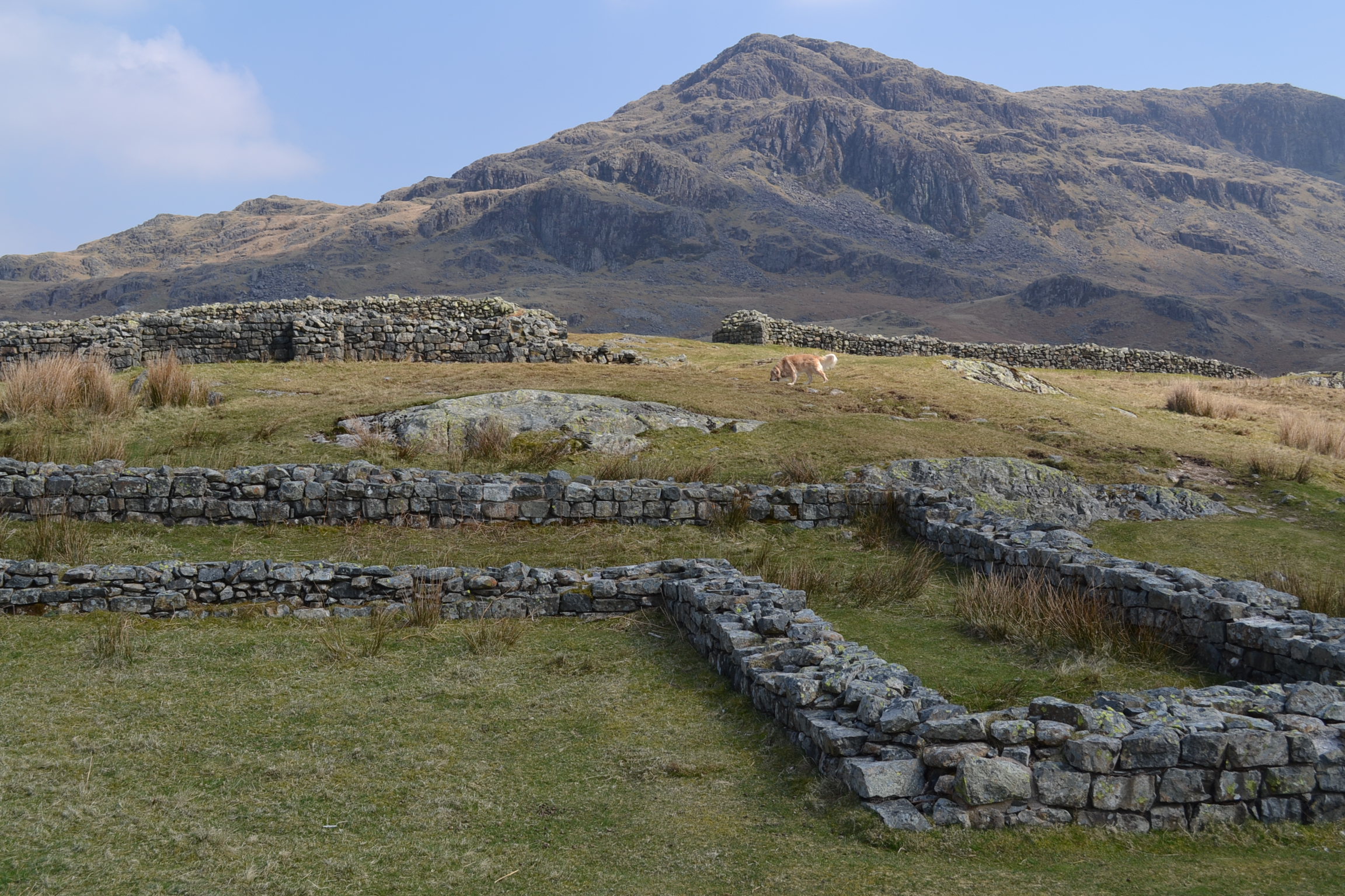
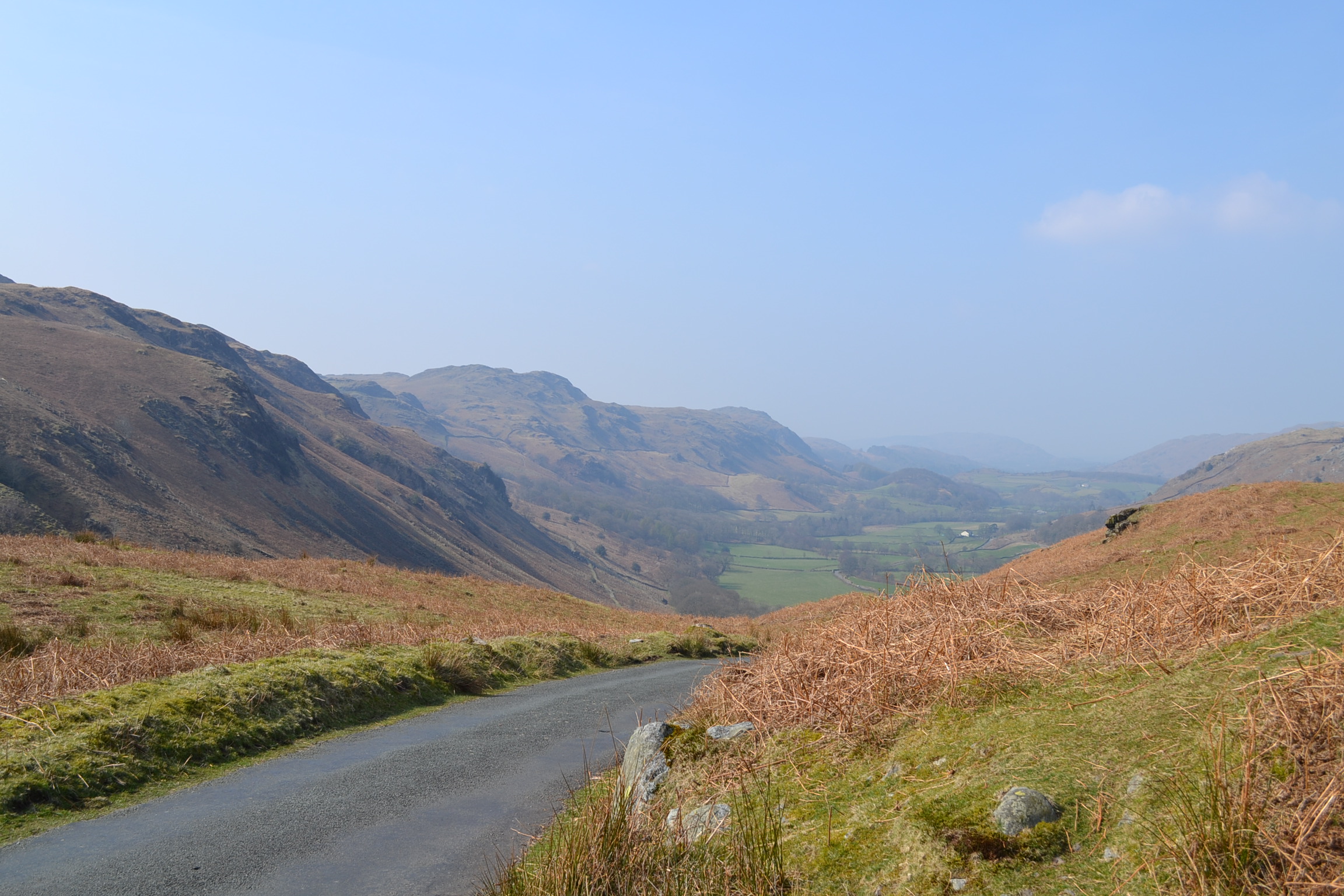
High in the mountain passes of the Lake District in northwest England, some distance from Cambridgeshire, lies a long ruined Roman fortress that once guarded the northern borders of the Roman Empire. It is hard to imagine a time when the beauty and tranquillity of Cumbria, now so often visited by hikers and outdoor enthusiasts, was a battlefield. In the early Second Century, during the reign of Emperor Hadrian, the Mediobogdum Fort was constructed along a chain of fortifications to prevent an invasion of Roman Britain (we are reasonably sure that Mediobogdum is now identified as the Hardknott Roman Fort). It was built along the mountain pass that left the port of Glannoventa (modern day Ravenglass) in the Eskdale Valley and crossed the hardknott mountain towards Windermere. Nowadays, the single-track road is notorious as the steepest and most treacherous mountain track in all of Great Britain, loved by motoring enthusiasts. One can imagine at the difficulty of garrisoning, supplying and constructing a military encampment high in the mountains of the Lake District – what is even difficult to access by auto today.
This fort, built and occupied before Hadrian’s Wall was constructed several miles to the North, was at its time the last outpost of Empire – almost a thousand miles from the Imperial City of Rome. The remoteness of this posting would have been breath-taking for the 500 men and officers garrisoned here – who we know from extant Roman records were the Fourth Cohort of Dalmatians. These men were raised on the balmy eastern shores of the Adriatic Sea (present day Slovenia, Croatia, Montenegro, and Albania). They would have travelled overland across Europe and then sailed to western England to reach this hostile borderland, where conflict with Picts and other tribes from present day Scotland was a constant threat.
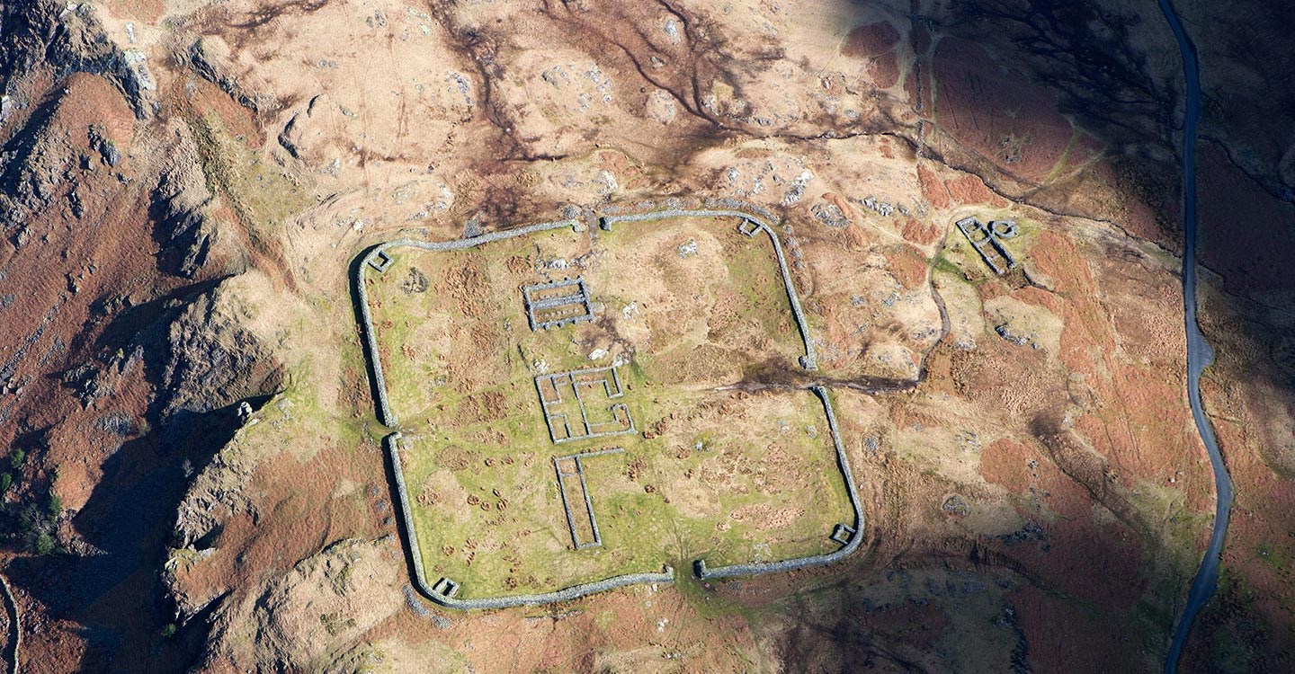
Laid out with military precision, it is still easy to walk the perfect square of Hardknott Fort, 110 meters per wall, with four gates and corner towers. The road of the day would have entered the fort via one gate and led travellers, merchants, and local peasants out through the opposite, ensuring the soldiers could maintain control of the key mountainous terrain, the movement of people and goods, and the levying of customs taxes. One nowadays can walk through the foundations of the Commanding Officer’s Praetorium, or villa. You can easily picture the wooden supports that would have comprised the barracks for the soldiers, junior officers, and auxiliaries, and think on the remoteness of this post. The foundations of the headquarters building, the granaries, and the forementioned Praetorium occupy the central ground of the fort. Just outside the northern gate is a parade field, a testament to the Roman Empire’s renowned discipline of its troops. A bit farther afield the ruins of a bath house remain, a reminder that not all of life in Mediobogdum would have been austere and grim.
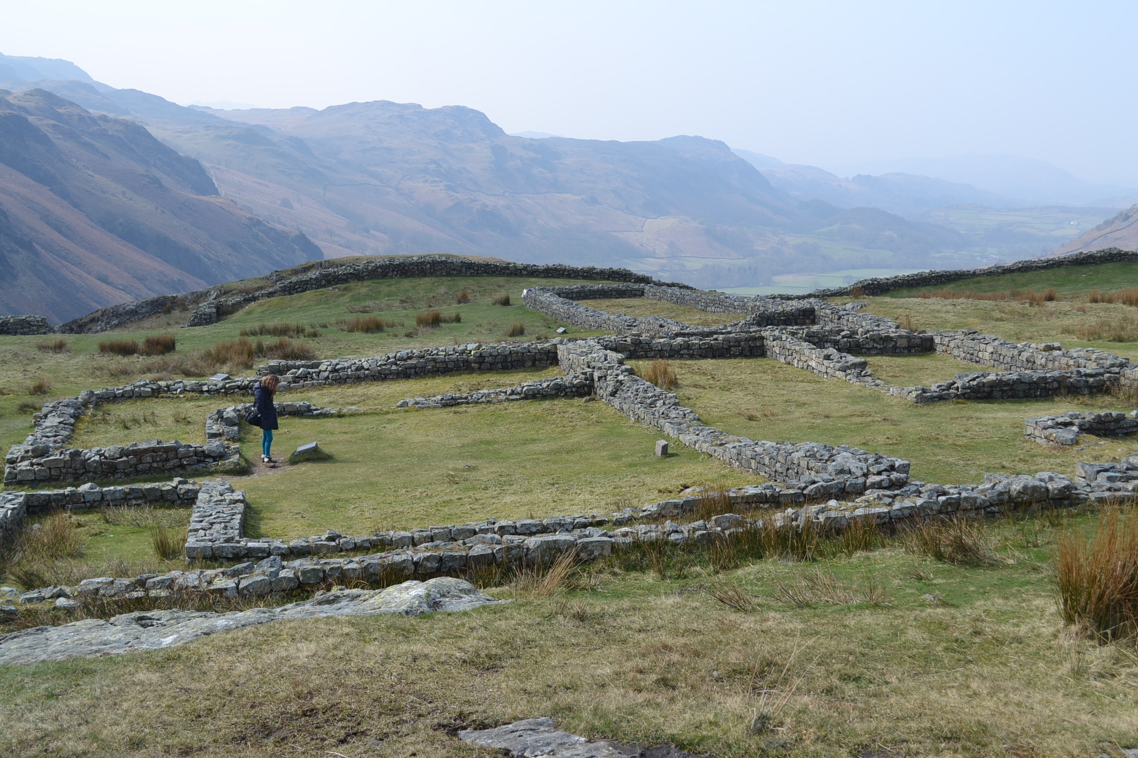
Today, Hardknott Fort is jointly preserved by both English Heritage and the National Trust. Not easily accessible, you must navigate the Hardknott Pass and then hike to the Fort, which is perched on the middle slopes of the Hardknott peak. Visit: http://www.english-heritage.org.uk/visit/places/hardknott-roman-fort/ for more information on the fort.

Spot on with this write-up, I honestly think this web site needs a lot more attention. I’ll probably be returning
to read more, thanks for the advice!
LikeLike
This is right next to where i live, some great photos and information here, thanks…
LikeLike
Small error “Just outside the northern gate is a parade field”. Just outside the northern gate is a steep drop.
Parade field is actually about 180-200m North-East, via the “East Gate”
LikeLike
Thanks Walker, good catch. To all readers, please don’t fall off a cliff reading this blog on your phone… best to keep your eyes on what you are doing!
LikeLike